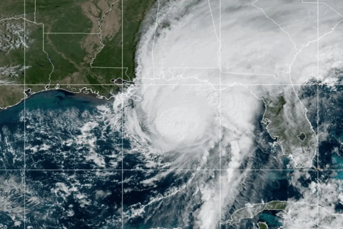
The first hurricane of the 2026 Atlantic season is about to make landfall, and it's arriving with force. Isaias is forecast to come ashore late Friday, Oct. 9, likely near the Florida-Alabama state line as a Category 3 storm on the Saffir-Simpson scale — sustained winds of 111-129 mph that forecasters class as capable of "devastating" damage. The National Hurricane Center logged peak sustained winds of 193 km/h before landfall, though wind shear is expected to shave some intensity off the system as it nears the coast. Officials stress it will still be dangerous.
Evacuation orders went out Friday in both Florida and Alabama, with Pensacola Bay flagged for a potentially deadly storm surge. Florida Governor Ron DeSantis declared a state of emergency across 25 counties, including Escambia, Santa Rosa, Okaloosa, Walton and Bell, urging residents to move just a few miles inland rather than drive hundreds — hurricane-rated shelters are open, and anyone outside low-lying flood zones may not need to leave at all. Across the state line, Alabama Governor Kay Ivey signed an emergency proclamation for 40 counties on Wednesday, effective 4:00 p.m. Central Time.
Alabama's beach tourism hub is essentially shutting down ahead of the storm. Gulf Shores closed the WC Holmes and AL-161 South bridges at noon Friday, with reopening only after inspectors clear the routes. A citywide curfew runs from 7:00 p.m. Friday to 7:00 a.m. Saturday, meant to keep roads open for emergency crews. Hurricane warnings also cover Mississippi, while tropical storm warnings stretch through parts of Louisiana and into Georgia, where evacuations were ordered too.
What makes Isaias notable is how it showed up at all. The season had been unusually quiet, which meteorologists credit largely to El Niño — the wind pattern shifts it brings tend to tear Atlantic cyclones apart. Isaias also left a mark on the way north, suspending classes in at least 18 municipalities in southern Mexico and closing Gulf ports after passing the Yucatán Peninsula.
Once inland and cut off from the Gulf's warm water, the storm should weaken, but its rain will spread across the southeastern U.S. as far north as the Tennessee Valley and the Carolinas, bringing travel disruption well beyond the immediate landfall zone.
For travellers, this is a firm stand-down moment for the Florida Panhandle, Gulf Shores and the wider Gulf Coast this weekend. Flights into Pensacola, Destin or Mobile are likely to be cancelled or delayed, coastal roads are closed or under curfew, and beaches will be off-limits. Anyone with trips booked in the coming days should contact airlines and accommodation providers about rebooking, monitor National Hurricane Center updates, and avoid travelling into warning areas until authorities confirm routes and bridges have reopened. If you're already in the region, follow local evacuation and shelter guidance — as officials emphasised, a few miles inland can be enough. Rain-related disruption may linger into next week further north, so itineraries touching Tennessee or the Carolinas deserve a second look too.