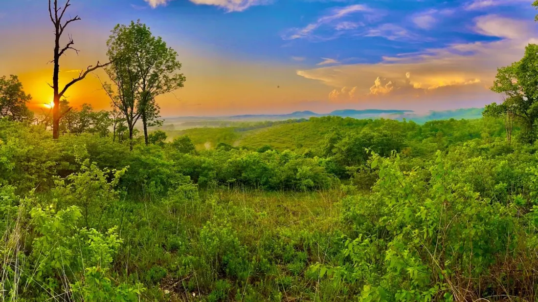
Twenty-three miles of gravel, ridgelines and rare wildflowers sit about an hour from Branson's theatres and arcades — and it's the only drive in Missouri with National Forest Scenic Byway status. The Glade Top Trail runs through the Mark Twain National Forest in the Ozarks, winding along ridge tops with views over the Springfield Plateau and, on clear days, Arkansas' Boston Mountains.
The road's name comes from the glades it passes: open, sunny clearings where dolomite and limestone bedrock breaks through the soil. Plants that survive both scorching summers and hard frosts grow here, including some of Missouri's rarest species, and the route crosses some of the largest preserved glades in the United States. Seven turn-offs give you panoramic viewpoints, and warmer months bring wildflower blooms plus wildlife worth watching for — wild turkeys, roadrunners and lizards all live along the route.
This is not a drive for speed. The gravel surface is maintained well enough for ordinary sedans, but there are narrow stretches and cattle guards to negotiate. If you want to explore side roads, four-wheel drive is a smart idea, and anyone in a rental car should check the contract first — many companies prohibit unpaved roads. Cell service is patchy, so download maps and anything else you need before setting off.
The trail doubles as a base for getting out on foot. Willie Lee Campground, just off the byway, offers dispersed camping and access to the 16-mile Bateman Trail, which threads through glades, streams and woodland. Hiking shoes and insect repellent are sensible additions to the day-trip kit, and the forest's springs and walking trails reward a longer stay.
Families have an option built in: the Caney Picnic Area along the route works with the Agents of Discovery app, which sends kids on a nature and science 'mission' around the site — download it in advance given the patchy signal. It's an easy stop for a snack with a view.
Access is straightforward from three directions. The most popular entry is from the northeast, about 20 minutes south of the town of Ava; the southern entrance sits just outside Longrun, and the western one is off State Highway 125 between Rueter and Bradleyville. Springfield-Branson National Airport is the nearest major gateway, roughly an hour and a half away, which makes the byway an easy add-on to an Ozarks or Branson trip.
Who's it for? Anyone who wants a low-cost, unhurried day away from Branson's shows and crowds — the trail suits all ages, works as a scenic cruise or a hiking-and-camping base, and delivers a genuinely wild slice of the Ozarks without demanding a serious off-road vehicle.